Document Author
Year Published
Topic
- (-) Remove Map Gallery filter Map Gallery
- 100% Access to Justice (1) Apply 100% Access to Justice filter
- About Cartography (1) Apply About Cartography filter
- ATJ Commissions (1) Apply ATJ Commissions filter
- Best Practices (1) Apply Best Practices filter
- Courts (1) Apply Courts filter
- Integration with Institutional Process (1) Apply Integration with Institutional Process filter
- Justice Tech Entrepreneurs (1) Apply Justice Tech Entrepreneurs filter
- LEP and Access (1) Apply LEP and Access filter
- Plain Language (1) Apply Plain Language filter
- Plain Language & LEP (1) Apply Plain Language & LEP filter
- Reports, Evaluations, Best Practices, Surveys (1) Apply Reports, Evaluations, Best Practices, Surveys filter
- Research (1) Apply Research filter
- State-by-State (1) Apply State-by-State filter
- State Language Access Plans (1) Apply State Language Access Plans filter
- Strategic Planning (1) Apply Strategic Planning filter
- Technology (1) Apply Technology filter
- Working Groups (1) Apply Working Groups filter
Tags
Post date
Results 1 - 2 of 2 for [2017-01-01T00:00:00Z TO 2018-01-01T00:00:00Z], [2017-05-01T00:00:00Z TO 2017-06-01T00:00:00Z], Map Gallery
Search results

Presentation: What’s In It For Me? How to Use Geospatial Data Visualization to Inform and Engage Decision Makers (EJC 2017)
At the 2017 American Bar Association (ABA) Equal Justice Conference and the National Meeting of State Access to Justice Chairs, Nancy Kinnally and Alison Davis-Holland shared their story of how they used geospatial data visualization and strategic messag ...

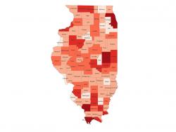
News: Illinois Supreme Court Commission on Access to Justice Uses SRLN Maps for Statewide Strategic Planning (Illinois Supreme Court 2017)
The Illinois Supreme Court Commission on Access to Justice has started using the SRLN demographics maps for presentations to circuit clerks, circuit court judges, civil legal aid and pro bono practitioners. “The maps helped provide context for why access ...